Version 3.9.13 of the processing engine is now deployed and introduces several new improvements and fixes. New changes to the GCP interface also add support for marking and using checkpoints.
Checkpoints
It's now possible to mark one or more ground control points as checkpoints. Checkpoints are useful for checking the accuracy of computation. They are left out from the computation and are instead used to measure the accuracy of the results.
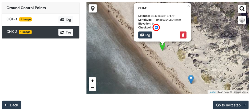
Checkpoints are then highlighted in the PDF quality reports as well as from the cloud interface Map View.
Improved GCP Handling
I've made changes to the ground control points alignment logic, which will now be able to better handle more difficult datasets.
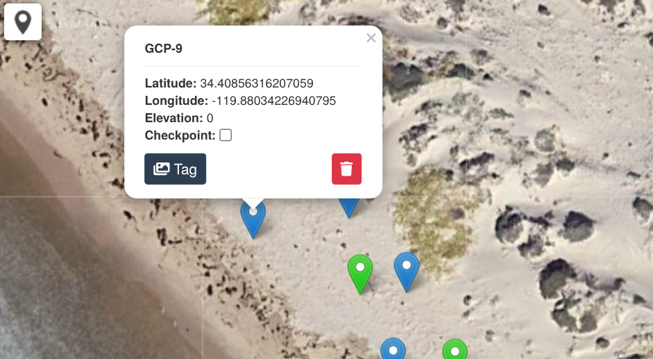
Updated GCP Interface
New changes to the GCP interface bring the latest EPSG database definitions, which means better coverage for inputting EPSG codes directly rather than needing to look-up PROJ.4 strings.
Better Support For Corridors
Corridor datasets are long, linear surveys that sometimes span a large geographical area. They are particularly difficult for photogrammetry software to handle because they can lead to the creation of very large rasters. I've implemented new changes that will provide faster and more reliable processing for these datasets. If you had issues processing corridors in the past, it's time to try again!
I've also added dozens of minor tweaks and fixes that are too little to mention, but that aim to improve both the reliability and quality of results.
Cheers!
-Piero